11 electorate names and 30 boundaries changed
11 electorate names and 30 boundaries changed
The electorate names and boundaries for the next two general
elections have been released, with a new electorate established in South
Auckland.
 Boundaries of 30 general electorates and 11 names have been changed,
with the most boundary changes in Auckland, Waikato, Otago, Southland,
and Christchurch.
This includes a redraw of the fastest growing electorate, Selwyn, which loses the Banks Peninsula area to the former Port Hills electorate - which has now renamed Banks Peninsula.
The new South Auckland electorate is called Takanini, rather than the initially proposed Flat Bush, and draws population from Manurewa, the former Hunua electorate, and Papakura and includes Wattle Downs and Takanini.
To move population southwards to create the new electorate consequential changes have been made to Mt Roskill, Maungakiekie, Manukau East and Manurewa.
The number of Maori electorates remains at seven, but five boundaries have changed, including Tāmaki Makaurau gaining an area around Te Atatū South from Te Tai Tokerau and an area to the east of Manurewa and Waiheke Island from Hauraki-Waikato.
A minor adjustment between Ikaroa-Rāwhiti and Te Tai Tonga has also been made in Naenae.
Other name changes include Rodney is renamed Whangaparāoa, Hunua becomes Port Waikato, and Dunedin South becomes Taieri.
The proposed electorates were released for public consultation in November.
Representation Commission Chair Judge Craig Thompson said the new names were either proposed by us or "suggested in public submissions to better describe the redrawn electorate areas.
"Where possible, we have maintained existing electorate boundaries and no changes have been made to 36 electorates.
"Now the boundaries and names have been finalised, we'd encourage people to go to www.vote.nz to check which electorate they are."
https://www.rnz.co.nz/news/political/414481/11-electorate-names-and-30-boundaries-changed

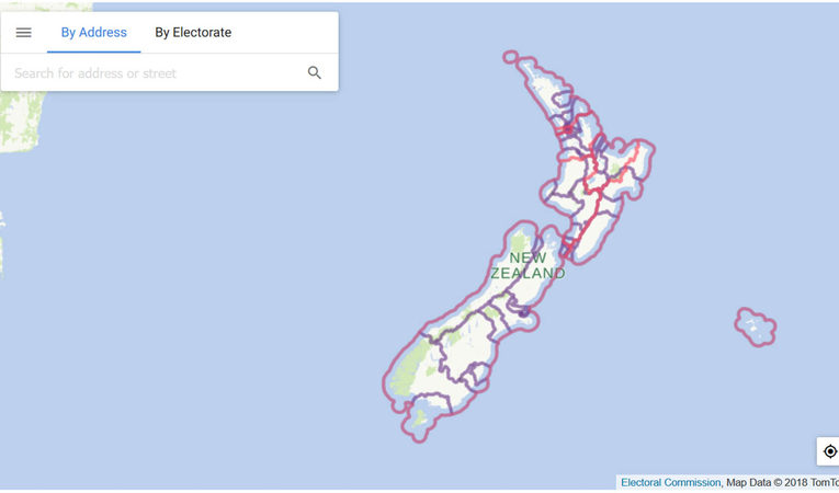
An electorate map from 2018.
Photo: Electoral Commission
This includes a redraw of the fastest growing electorate, Selwyn, which loses the Banks Peninsula area to the former Port Hills electorate - which has now renamed Banks Peninsula.
The new South Auckland electorate is called Takanini, rather than the initially proposed Flat Bush, and draws population from Manurewa, the former Hunua electorate, and Papakura and includes Wattle Downs and Takanini.
To move population southwards to create the new electorate consequential changes have been made to Mt Roskill, Maungakiekie, Manukau East and Manurewa.
The number of Maori electorates remains at seven, but five boundaries have changed, including Tāmaki Makaurau gaining an area around Te Atatū South from Te Tai Tokerau and an area to the east of Manurewa and Waiheke Island from Hauraki-Waikato.
A minor adjustment between Ikaroa-Rāwhiti and Te Tai Tonga has also been made in Naenae.
Other name changes include Rodney is renamed Whangaparāoa, Hunua becomes Port Waikato, and Dunedin South becomes Taieri.
The proposed electorates were released for public consultation in November.
Representation Commission Chair Judge Craig Thompson said the new names were either proposed by us or "suggested in public submissions to better describe the redrawn electorate areas.
"Where possible, we have maintained existing electorate boundaries and no changes have been made to 36 electorates.
"Now the boundaries and names have been finalised, we'd encourage people to go to www.vote.nz to check which electorate they are."
https://www.rnz.co.nz/news/political/414481/11-electorate-names-and-30-boundaries-changed


Comments
Post a Comment